Posts

Showing posts with the label maps

Setting Review: Primeval Thule (+new setting map)

Image
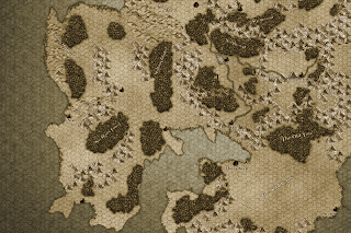
NB. If you're only here for the cool new map, it's at the bottom of the post. Primeval Thule is a "sword and sorcery" pastiche setting that takes its primary inspiration from Robert E. Howard, Clark Ashton Smith and H.P. Lovecraft - For D&D. It has books for 5e, 4e, pathfinder, 13th Age and Savage Worlds. Here I will be reviewing the book for 5e. Despite the strong influence these authors have had on the D&D genre, D&D settings who take these as a primary and overriding influence are rare, so a setting adopting a more purist interpretation of these is a welcome addition. The concept art for the setting certainly makes an evocative intro: What other settings might compare to such an effort? Setting to one side pastiche OSR efforts (such as Astonishing Swordsmen & Sorcerers of Hyperborea), then Wilderlands of High Fantasy has a lot of S&S, but its (delightful) kitchen sink approach means it can not be considered a

Fantasy Map Review VII: Erce

Image
For links to all instalments in this series,  go here . Final instalment in my review series of classical maps is my own - The Mythlands of Erce! The main large map is more or less finished by now. Click here to download the full size 6000x4000 map It would seem a bit puerile to review what I like and don't like about my own map, so I am just going to talk a bit about what I am trying to do with it, the process and how I feel about the result. One of the touches I am pretty happy with (and which really helped me figure out the proper scale of symbols as well) is that this is actually a hex map. Each mountain is a hex, woodlands border to hexes, albeit lazily, so do hills, etc. So this can actually be used a table, players can be told what hex they are in and see what can of primary terrain it has, calculate overland travel, etc (I didn't go for hexes for the seas because imo, sea travel is almost always a pointcrawl anyway). I feel like I have to show a slightly

Fantasy Map Review - A Teaser for Erce

Image
I've been stalling on finishing my  Map Review Series  - Given that the last one to review is my own. I am a bit shy and self-conscious about it really, given the body of work I have reviewed prior to it. Anyway, I probably should just accept it will never be finished and get around to sharing it. Until then, here is a teaser to share with players for the Calmir Eastwilds, one of the Borderland regions in Erce and one of the prime campaign areas Here is a snapshot of the whole setting and where the Eastwilds fit in.

Fantasy Map Review VI: Nentir Vale

Image
For links to all instalments in this series,  go here . For the sixth instalment, we visit Nentir Vale, the default setting of 4e. I must admit, I steered well clear of 4e for a long time. But the fluff of it possibly the strongest OSR credentials of any editions. It is eminent and at times simply brilliant. First Impressions:  I like it. As a starting DM I feel like this map is much more relate-able than the other maps. This evokes feelings more like the  Domain of Greyhawk , where the local campaign asserts its relevance evocatively on the map. Further Thoughts:  In scale, it is more reminiscent of  Middle Earth , but, unlike ME, it has a sense of  locations  that give PCs a sense of the area they are exploring. Although not as flavorful as  ME, it does give a sense of being enough for a local campaign for ant adventurers who aren't too afflicted with wanderlust. For the far thinking explorer it falls short quickly. But it knows what it wants to be. And, unlike 4e forg

Fantasy Map Review V: Birthright

Image
For links to all instalments in this series,  go here . For the fifth instalment, we come to Cerilia of the Birthright setting. And I move from admiration to love. First Impressions:  I first became aware of birthright when the  Birthright Conspectus  was included in one of the boxed sets I bought at the time, which included the fullsized map above. It was, simply put, love at first sight. I adored the the woodlands, the mountains, the colour scheme and the stapled borders  - It seemed like a world truly alive. More than anything, it was the map that made me want to know more about this setting. Further Thoughts: This is is still one of my favourite maps, maybe my alltime favourite. Although the scale of Cerilia is clearly more localised than Faerun or even the Flanaess , the sense of there being plenty of opportunity for exploration and adventure is developed with stunning level of detail instead - Where the Forgotten Realms gives a sense of never running out of new land

Fantasy Map Review IV: Forgotten Realms

Image
For links to all instalments in this series,  go here . For the fourth instalment is yet another iconic map piece - Faerun. I've gone for the 3rd edition one as that is probably the most widespread one out there and also (imo), the best. Ed greenwood does a lot of the same things right as Gygax did with his Flanaess map. He understands that placement of seas as separators; points that cultures congregate around; and routes that open up and connects different adventuring areas really makes a difference to a good map. He nails it with the Sea of Fallen Stars and the multitude of bays, lakes and reaches that feed into it. One boat can set sail in the sea of salt in Mulhorand in the deep south and meet up in the Sea of Fallen Stars with a vessel that started from the tortured lands near the great glacier, passing through Damara, Vaasa and Impiltur before entering the sea proper. Great stuff. What is really striking about this map is the scale of it. It feels larger than th

Fantasy Map Review III: Dragonlance

Image
For links to all instalments in this series, go here . Next up is another map many will know but few have praised - The map of Ansalon from the 2nd edition Dragonlance boxed set "Tales of the Lance". First Impressions: My initial impression is not as favourable as the preceeding ones, but there are still some interesting things going on here: The gulf of the new sea tells a story about how kingdoms shape up in central ansalon. Southern Ergoth looks like a kickass island of adventure. And I want to know more about that southwestern strip of the mainland bordering Southern Ergoth. I'd also like to know more about those island kingdoms up in the northeast corner. And what's going on around the Bay of Balifor? Besides that, the north and south just sort of... end, with wastelands at each end (plains of dust/Icewall, Northern Wastes/Nordmaar). The bloodsea puts a downer on what could have been an eastern Ansalon full of vitality. And the centre of the mainland

Fantasy Map Review II: Greyhawk

Image
For links to all instalments in this series,  go here. Second instalment in the series gives a strong showing with another iconic example - The Flanaess as depicted in the World of Greyhawk Folio from 1980: First Impressions: It is with a certain amount of awe that I delicately unfold my original Darlene maps from the Greyhawk folio - Still in top notch shape after 35 years thanks to the sturdy paper the folio edition were printed on. From a gamer's perspective, you can't ask for more  - They are huge, sturdy enough to take to the table and have a lot going on. Not as beautiful and flavourful as Middle Earth, but still a work of art. And hex-mapped. All awesome. Further Thoughts:  The Flanaess is to me the gold standard of how to draw up a setting map. No borders are drawn and none are needed. The geography naturally points out how regions are shaped and interact with each other. You can learn a lot about the Flanaess just from this map: The Sheldomar Valley countri

Fantasy Map Review I: Middle Earth

Image
For links to all instalments in this series,  go here. We're off to a somewhat lacklustre start with perhaps the most iconic fantasy map of all - J.R.R. Tolkien's Middle Earth First impressions: Love the style, it is immensely flavourful and says something about kind of world Middle Earth is. It makes me want to dig into its pockets and see what mysteries have been scribbled on to this piece of lore. Second thoughts - As a setting map, Middle Earth is, geographically speaking, dull as dishwater. Just a slab of land with a coastline, a few mountains and woods dotted here and there. For an entire setting, it doesn't give you much to explore or evoke many impressions about the realms there and how they relate to each  other. Some will argue that there is more to Middle Earth than this, but not effectively so. This is the main campaign map the same way the Flanaess is the main area of Oerik and Faerun is the main area of Toril. As a setting map, it falls flat - Ju

MAPS. It's a big thing

Man, maps. As a teenager I spent hours pouring over them,studying areas and worlds based on them. Who was neighbouring who and what areas did they have to go through to get to each other? How many day travels deep is that forest? How few roads are in that area? How many towns per days of wilderness? I sort of left behind this level of scrutiny in my 20s in favour of more explicit and condensed information but I don't think now that this was for the better. These sort of questions are evocative and immersive. A map says a lot about the kind of setting you are dealing with. The map of Erce has gone through a lot of evolution over the years. About a year ago I thought I had settled on the map structure, but even now I am making small changes to the continent. Over the next few weeks, I will discuss different setting maps, how they inspire (and how they don't) and wrap it up with an introduction to the actual map of Erce,it's evolution, why it is way it is, what I like